Middle Fork Trailhead to Mile 72 on the Kaweah
(14 miles, +6,000/-3,000 feet).
I had originally planned to knock out 48 miles on the PCT this weekend, but it was supposed to be extremely windy in the Mojave and I have been really craving a return to the Sierra.
The weather gods helped me out, ending a storm early and giving me a window of three clear and warm days to try out a low elevation trail along the Middle Fork of the Kaweah River. This trail runs below and parallel to the High Sierra Trail, so I was hoping it would give me some fantastic views of the snowy mountains. (Spoiler: it didn’t disappoint!)
I left San Diego at about 3am and arrived at the Foothills Visitor Center by 9am. I would have gotten there a bit earlier, but a drowsy fit forced me to pull over and take a 30 minute nap on the drive up.
I was a little nervous about the big rainfall that came yesterday. I heard that they had actually closed Yosemite Valley due to above flood stage river levels! So after I filled out my self-serve permit I wandered around the visitor center looking for someone who might have some beta on the water levels in Sequoia.
The backcountry office is closed on the weekend and the front country rangers are actually not allowed to give advice on backcountry trails. But the nice ranger did tell me that the peak water flows already passed.
I headed back to my car optimistic that I would be able to make it to Redwood Meadow Grove by nightfall.
I wasn’t sure if I would be able to make it to the trailhead. Buckeye Flat is not open year round, so sometimes the road to it (and my trailhead) is closed. That would add an extra 2 miles and 600 feet of elevation gain. But fortunately the gate was open and I was able to (very carefully!) steer my Honda along the rocky one lane path clinging to the side of the mountain above the now-slightly-less-raging Kaweah.

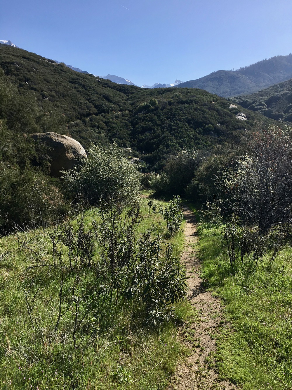
I expected my feet to get wet today, but not on the very first creek crossing! Moro creek is just a couple hundred meters from the trailhead and when I got there I could not find a way to rockhop across it. The usual way was under about 6 inches too much water to make it work. I briefly tried searching upstream for another way, but it gets steep really quickly, so I just accepted my fate and waded across.

As the trail wound upward Moro Rock came into view. I remembered the time when my whole family was up on top for a photo op.

Meanwhile, on the south side of the valley I started to get nice views of Castle Rocks.

Right in the middle of the trail was an immobilized reptile of some kind waiting for the sun to give it some energy.

After about three miles I reached Panther Creek. This time there were plenty of rocks and logs to get across dry.


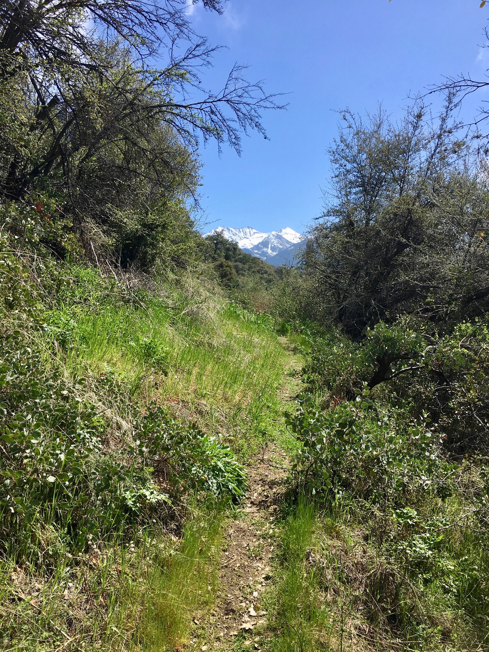
I got very excited when snowy mountains started coming into view.

By 12:30pm I was at Mehrten Creek, again easily crossable on rocks and logs.

As I climbed higher and higher the forest was slowly transitioning from chaparral and oak groves to pines and cedars.

Low hanging clouds started to form as the warm mid-day sun burned off the recent rainfall.


As I crossed above 5000 feet, the Five Spots were bursting out everywhere.


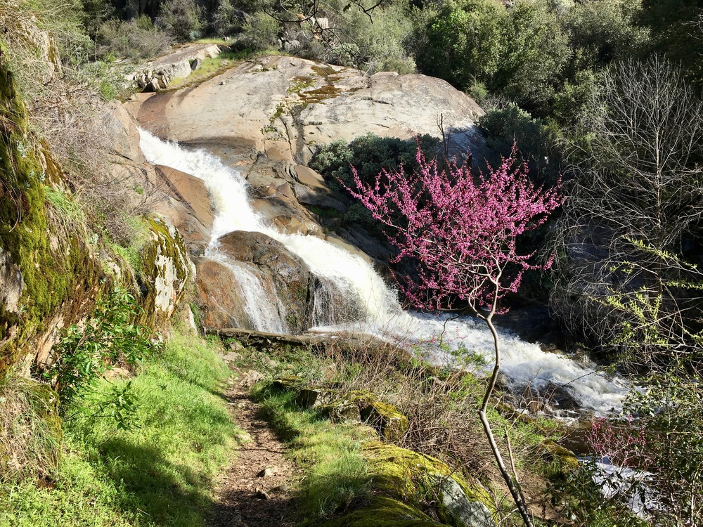
I could hear Buck Creek raging, so I began to get nervous about the upcoming crossing, but then I saw this:


There were clear signs everywhere that the creek had been even higher recently

Every step closer to the Sierra made me happier and happier.


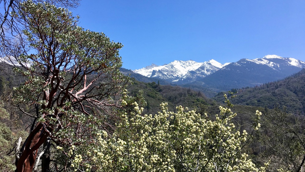
Soon I got my first view of Redwood Meadow Grove, my goal for today, and Hamilton Lake basin, my goal for tomorrow

I was really, really, really hoping there was a bridge across the Kaweah, since I could not imagine actually crossing it in its current state. And I wasn’t disappointed:


But I had not studied the map as carefully as I should have. There are actually two river crossings to get to Redwood Meadow Grove. Unfortunately there is no bridge over Granite Creek.


I pulled out the map and saw another trail headed up the north bank of Granite Creek past the point where it joins with Eagle Scout Creek. I was hoping there might be a way to cross it one half at a time. But when I finally got to the Eagle Scout Creek crossing, it was also quite daunting.

It was very disappointing to be cut off from my goal. And I actually think I might have been able to cross the creek if I had some help. But with two PCT deaths last year due to solo sierra creek crossings on my mind, I sounded the retreat bugle and got a head start on my plan for tomorrow: Hamilton Lake.
I backtracked to the trail on the south side of the Kaweah and then followed it up stream to where the map showed another crossing. But once again it was a sketchy ford:

So my choices were to backtrack all the way to the Kaweah bridge and then head up to Bearpaw Meadow or bushwhack upstream on the south side of the Kaweah all the way to where it crosses the High Sierra Trail.
Always a glutton for punishment, I chose the latter.
And OH MY FUCKING GOD it was hard.
I learned all about willows. They have a current! The snows weigh them down so they point downhill. If you want to cross them it is easier to flow with them diagonally downhill until you find a break in the vegetation that allows you to regain your elevation.
And forget about getting through them on the valley floor. They are so thick there that they claimed both my water bottle and my peanut butter jar (I felt really guilty about depositing plastic in the wilderness).
But here’s the thing. In spite of the difficulty, occasionally I would emerge from the brush to see things like this:


Crossing the snow in the afternoon warmth was pretty easy and such a relief after fighting for every inch through the vegetation.
Around 6pm I began to realize that I needed to get back down to the river if I was going to find a flat spot to set up camp before dark.

I got pretty lucky, finding a sand and rock bar about 4 feet above the river. Oddly there was an old campfire ring there, too. I guess I’m not the only crazy one.
I could just barely make out the Kaweah falls across the High Sierra Trail through the trees from my campsite.

I planned to take some more photos and think about tomorrow’s plan, but a crazy fog suddenly creeped up the valley, enveloping the area in a soothing (creepy?) darkness.

And yes, I slept like the dead.
